

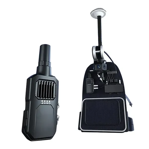

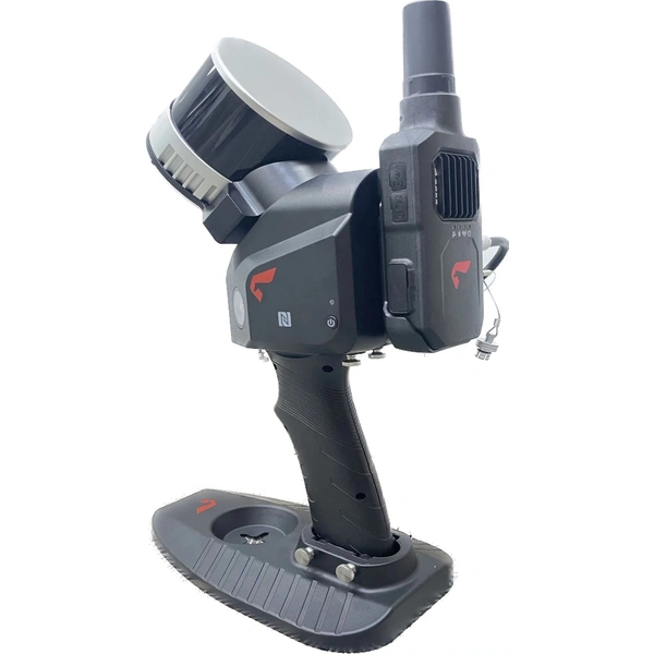

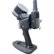
SLAM100 is the first handheld mobile lidar scanner. The system has a 360°rotating head, which can form a270°x360° point cloud coverage. Combined with the industry-level SLAM algorithm, it can obtain high-precision three-dimensional point cloud data of the surrounding environment without light and GPS.
SLAM100 adopts three 5-megapixel cameras to form an ultra-wide field of view with a width of200° and a height of100°.It can simultaneously obtain texture information under light
conditions and generate color point clouds and partial stitched panoramic images.
SLAM100 adopts an integrated structure design with a built-in control and storage system and built-in replaceable lithium batteries. Once press the start button, SLAM100 can start operations immediately, making data acquisition more efficient and convenient. SLAM GO is the mobile APP for SLAM100 to view and manage projects, which would automatically be synced to the cloud to furthermore perform real-time SLAM mappings and previews. Moreover, SLAM GO can be utilized to perform operations such as firmware upgrades and equipment maintenance. SLAM GO POST, as a PC software module integrated in UAV Manager Professional Edition which is a comprehensive software plat- form, can realize the functions of data post-processing, color point could production, data stitching, data optimization, data preview and measurement and so on.
SLAM100 can be widely used in various applications such as traditional surveying and mapping, enclosed space, three-dimensional digitization, emergency response and so on due to its portability, GPS-free, and multi-platform mounting ability.


